Please ensure Javascript is enabled for purposes of website accessibility

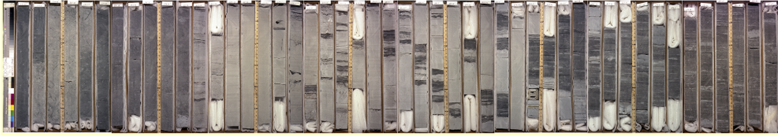
EPR Price River C lower

EPR Price River C, lower is through the Panther Tongue Sandstone in a medial delta parasequence with the overlying flooding surface and offshore mudstone

Drilled in 1982

39°43'50.69"N

110°52'12.68"W

Price River C.kmz

LAS log files

Price_River_C.las.zip

Scans of paper logs

PriceRiverC_Log_PantherTongue.tif.zip


Core section

Click the link below below to download a jpg of the image. This is the highest resolution available.

Entire core

PriceRiverC_PantherTongue.jpg


Links to the original negative scans

574_37-587_85.tif

590_68-604.25.tif

607_08-619_1.tif

621_85-633_9.tif

636_49-648_33.tif

651_3-662_95.tif

665_72-676_7.tif

677_89-691_65.tif

693_8-706_4.tif

We value your privacy

We use your data to provide and improve the Service. By using the Service, you agree to the collection and use of information in accordance with this policy.

By clicking “Accept All Cookies”, you consent to our usage of cookies in order to have the best possible experience on your device(s) in regard to enhanced site navigation, structure, analyze, marketing and performance.

We value your privacy

While using our Service, we may ask you to provide us with certain personally identifiable information that can be used to contact or identify you ("Personal Data"). Personally identifiable information may include, but is not limited to:

  • Email address
  • First and Last name
  • Phone number
  • Address, State, Province, ZIP/Postal code, City
  • Cookies and Usage Data

By clicking “Allow All” you consent to our usage of cookies in order to have the best possible experience on our websites. You can also set your preferences or reject cookies (excluding "Required" cookies)